
Zambia Electoral Geospatial Dataset (1991–2021): Electoral Results and Boundary Shapefiles at Ward, Constituency, and District Levels
Description
Electoral results and boundary shapefiles at ward, constituency and district levels
At a glance
Elections from 1991 to 2021 · Ward, constituency and district levels · Boundary shapefiles for three delimitation epochs
Abstract
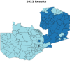
This open‑access dataset contains official Electoral Commission of Zambia (ECZ) election results for presidential, parliamentary, mayoral, and councillor elections held between 1991 and 2021, harmonised with geospatial boundary shapefiles across three delimitation epochs. Results are standardised at the constituency level (presidential and parliamentary), ward level (councillor), and district level (mayoral), enabling seamless longitudinal analysis, spatial modelling, and policy research on Zambian electoral geography. The dataset includes concordance tables to bridge boundary changes, a comprehensive codebook, and fully documented extraction scripts. Year of Publication
2026
Repository
Zenodo
Data
https://www.kaggle.com/datasets/lightonphiri/zambia-electoral-geospatial-dataset-19912021
DOI
10.5281/zenodo.21709654
Licence
CC BY 4.0
|